| Washington State & Oregon (Northwest) |
|
Heliotrope Ridge - Mount Baker and Snoqualmie National Forest, Washington Skyline Divide - Mount Baker-Snoqualmie National Forest, Washington Mora – Lapush & Hoh Rain Forest Hikes – Olympic National Park, WA Maple Pass Loop - Mount Baker-Snoqualmie National Forest, Washington Hidden Lake - Mount Baker-Snoqualmie National Forest, Washington Side Trip - Cascade Pass-Sahale Arm, Hannegan Pass, Windy Pass & Mt. Rainer's Skyline Loop Trail Heliotrope Ridge - Mount Baker and Snoqualmie National Forest, Washington This is one of our favorite trails – glaciers at arm lengths away, carpets of wild flowers, icy cold streams and spectacular mountain views. If you like Alpine country, you’ll love this trail. Getting to the trailhead requires you to take a winding gravel road (#9) for about 8 miles off Mt. Baker Highway 542, near Deming, WA. The turnoff is approx 1 mile from the Glacier Public Service Center, traveling east on the highway. The trail starts off on your left hand side when you arrive at the parking lot. Most of the trial was a long winding climb through the forest. When we reached inched closer to the end of the trail, we saw a fork in the trail with a sign “Climber’s Route” pointing to a steep trail to our right. Note: Unless you are dead tired, you MUST take the climber’s route or you’ll miss some spectacular scenery. We continued on the main trail and the most challenging part of the hike was the stream crossings. The crystal clear glacier runoff was so cold that our feet felt like it was being scalded; it was pretty painful. After the last stream-crossing, we were abruptly stopped by the Coleman Glacier with a couple hundred feet of jaw-dropping drop offs in front of us. What greeted us were scary looking seracs sending off menacing vibes…but its awesomeness was unmatched by anything we have ever seen. We stood there and I was gasping for air. We decided to press on and continued along the lateral moraine (edge of the cliff). From here, the trail became more precarious and turned into a scrambling route. We went as far as we could without the need of protection and traced our steps back. On the way back, needless to say we refused to take another dip in the glacier water and managed to hop over rocks to cross the streams. With plenty of daylight left, we took the climber’s route to the left. A local hiker told us we would enjoy the ‘hog’s back’ immensely and he was absolutely correct. The steep climb on the back of this stupendous pig drew more breathless wows. We stopped when we arrived at the summiter’s Base Camp. Watching climbers practicing self-arrest and crevasse rescue below the 10775 feet summit tells us today is not a day for us to go up any higher, maybe another day when we are more prepared. Tips: do not attempt the stream crossing if water volume is high, with the sun, afternoon melts will only worsen the condition of the streams. Do not attempt glacier travel unless you are properly trained and carry the right equipment. Walking on the glacier is dangerous even for a few steps.
Rating: 9 out of 10
Skyline Divide - Mount Baker-Snoqualmie National Forest, Washington Skyline Divide is another spectacular trail in the foot of Mt. Baker. It offers expansive views of alpine country and distant peaks. Getting to the trailhead requires a drive through FR 37 off the Glacier Creek Road, I remembered taking the gravel road on the left when we arrived at a fork not far from the mouth of the FR. There should be a sign to indicate Skyline Divide (left) or Heliotrope Ridge (straight/right). Heliotrope Ridge and Skyline Divide share the same turnoff at the Glacier Creek Road. (Also see Heliotrope Ridge). From the trailhead, the long climb to the top was similar to that of the Heliotrope Ridge. The switchbacks through the forest were probably the most boring part of the climb (unless you spot a black bear). But you will know when you are near the top when forests open up to an open ridge/grassy plateau. Mary said this place reminded her of scenes from the Sounds of Music. We have arrived - this is Skyline Divide. The top of the bowl shaped grassy valley offered a spectacular spot to have a picnic. We travelled to the left and had a picnic next to a cliff, with a view of countless snow capped peaks in the distance. The trails to the left dead-end quickly with views covered by trees. We then traced our steps back to the top of the trailhead and continued to follow the ridge trail. The trail extended as far away as Mt. Baker and begged us to hike more…to see what’s around the next bend. Here, we clearly saw both Mount Baker and Mount Shuksan (toward Southeast). Mt. Baker was getting closer but we knew it’ll take another day to get to the foot of the mountain. After traveling about a mile or two, crossing 3 ‘towers’, we decided to head back. Tips: dress in layers and establish a turnaround time, its easy to “keep going” on this trail and overestimate yourself! If traveling in early/late winter, bring traction aids for your boots. Drive slow especially on your way down, lots of blind curves.
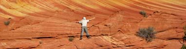
Mora – Lapush & Hoh Rain Forest Hikes – Olympic National Park, WA Olympic National Park is so vast and dispersed that we cannot cover every area in one report. There are six regions including coast, rain forest, glaciers, alpine meadows, waterfalls and just about every climate zone imaginable. Posting all hikes for these 2 regions will likely max out my server limit. This is certainly one of the most unique parks we have ever visited. During the week of our 1st visit to Washington Cascades, we took a couple of days off from the mountains and explored the coast and rain forests of Olympics since the scenery of these two places differ the most from the Cascades. There are longer coaster hikes at the Northwest (tip) of the peninsula. During this visit, we opted to stop at the town of Mora and hiked the 2nd and 3rd beach. The 1st beach was closed the day we visited. The trailheads were clearly identifiable off HWY (110). If you can only hike one trail, make it the Second Beach. There were only 2 sections to this hike – 1st section was a gentle stroll through the giant forests and ferns. The second section offered jaw dropping views of giant driftwood and thundering surf, punctuated by colorful tidal pools. After soaking up enough salty smell on the beach, we drove South along HWY 110, continued East on Upper Hoh Road to the Hoh Rain Forest visitor’s center. You have the option to start a mega track Eastwardfrom here with crampons and ice ace on your back, or you can take a stroll like us and through a interpretive trail and mingle with the tourists. The trail (Hall of Mosses) was a short 0.75 round trip begins at the Visitor Center. It was fascinating to see such lush vegetation, droopy ferns and giant trees covered in moss. This can be a great place for a movie set; these trees remind me of the living trees in those Fantasy movies – “And do you know Gandalf”, said Treebeard. TIPS: expect weather change in Olympics and bring the appropriate layers, the beach was shrouded in fog when we arrived and quickly gave away to sunshine before dark, then wind gusts penetrated our light rain jackets like it wasn’t even there. Length: ~varies (2-4 miles) Rating: 8 out of 10 (Beach), 7 out of 10 (Rain Forest)
Maple Pass Loop - Mount Baker-Snoqualmie National Forest, Washington The Maple Pass Loop was a hidden jewel. It exceeded our expectation in every way possible and gave us a little bit of everything – ridge tops, saddle tops, lakes, forests, waterfalls, and 360 alpine views. The trailhead for Maple Pass was somewhat hidden/not advertised and is located at the Rainy pass trailhead off Mt. Baker highway, at mile marker 157. The loop can be accomplished in either direction but we chose to hike it counter-clockwise for a gentler ascent. The trails was typical of other famous hikes in the Cascades area, it started off in the forest for over a mile. As we poked our heads out of the forest, we joked with each other that we will climb to the top of the saddle at 11 O’clock before us. As usual, the saddle top looked unreachable but a tiny spec far into the distance. It was only later that we learned the saddle top is the actual Maple Pass, and the climax of the hike. We followed a gradual climb encircling the 'right side' of Lake Ann to the top of the ridge. The ridge walk offered incredible views extending in every direction – 2 V-Shaped valleys are in clear view on both sides of the ridge top. We encountered some snow/icy during this section and was forced to put on some traction aids on our shoes. This snowy section crossed Heather Pass (~6200 ft.), Maple Pass (~6600 ft.) and topped out at about 7000 feet. A lone stump and a sign signal the highest point on the trail. After reaching the highest point, the trail decented quickly down a ridgeline with view of two lakes on each side – serendipitously to the left Lake Ann reappeared and to the right is Rainy Lake. In the distance, a giant waterfall cascading down the Rainy Lake came into view. Overall, this was a gorgeous hike and we were surrounded by a kaleidoscope of turquoise lakes, yellow pines, red maples and lavender blue-berry bushes. The snow, fog and ice were thrown into the picture to created dreamlike scenery with every picture a fairyland, came true! Tips: do not attempt the stream crossing if water volume is high, with the sun, afternoon melts will only worsen the condition of the streams and you may have to bivouac with a teddy bear to keep you warm overnight. Bring adequate rain gear - just ask yourself a question if it pours for 30mins, will any of my body parts get wet... Length: ~8 miles Rating: 9 out of 10
Hidden Lake - Mount Baker-Snoqualmie National Forest, Washington Hidden Lake Trail is one of the most popular hikes in the North Cascades. It is a backpacking and day hiking trail with multiple back country campsites dotted along the way. The Lookout at the terminus of the trail can also be used for an overnight stay on a 1st come 1st stay basis. The trailhead is located near Marblemount - after passing the steel bridge, take a ~15 mile drive (9.5 miles paved plus 4+ miles gravel). The gravel road is steep and a 4WD vehicle is recommended when icy/snowy conditions are expected. This hike turned out to be a total surprise. This was neither the longest nor the highest (in terms of elevation gain/loss) hikes we have accomplished, but on the day as we slogged our way up the switchbacks, it dawned on us that we had underestimated the inexplicable beauty of the hike, the sheer toughness of the climbs and the time needed to ascent. We started off with a few setbacks due to sloppy planning – having wet and soggy weather, hiked maple pass the day before, without a good breakfast, only one headlamp low on battery, and started late in the morning (at 9am). As we progressed, the wet condition and the warm weather (above freezing) contribute to our slow progress, and eventually it took every ounce of energy we had to make it back. The wet condition and the muddy slosh also tested the water proof-ness of our gear. We encountered countless number of water crossings, and recent rain turned some creeks into mini waterfalls. Our boots leaked and we were forced to endure a squishy ascent to the top. Overall, the hike can be described as having 5 distinctive sections. Section one consists of ~1.0+ miles of switchback in the forest, section 2 consists of a well-graded switchback up an valley/basin, section 3 consists of a less steep traverse along the sides of the mountain ridge encircled by blueberry fields, section 4 consists of rocky ridge top ascent to a saddle/the base of the Lookout (to reveal the true meaning of “Hidden” lake), and section 5 is the actual climb to the Lookout. Overall, without a doubt this was one the most beautiful hike we have ever accomplished. The white granite, snow, ice, and clouds punctuated by the red bushes of the blueberry created dramatic images; a truly picture perfect setting to enjoy God’s gift to us. Other than the 1st Section of the hike in the forest, there was constant view of the surrounding mountains to the top. This was one of the few times where one of us (Mary) had some doubt about having enough time making it to the top and return to the trailhead with enough daylight. When we finally saw the Lookout after a strenuous climb through the slosh (at the beginning of Section 4), we starred at each other and said "Are you kidding me?" We both though we had already reached the Lookout at the top of the basin. Now standing infront of us is that tiny shack perched precariously on top of a peak looked impossibly far away. It was snuggled among slabs of menacing looking granite – an awesome yet eerie sight. Somehow, we managed to encourage each other and made it to the base of the Lookout. We met a couple who set out about 2 hours earlier and they turned around halfway through the climb due to the steepness and the poor condition of the trail. Hearing this, I felt a sudden surge of energy… my primitive, alpha male mindset took over and we just took off like 2 mad man/women and climbed to the top the Lookout in one breath. It probably only took us 10 mins to climb 300 feet. It was only during descent we realized how dangerous the trail looked. We said to each other while starring down the steep switchback – “did we come up this way? NO WAY!” It was during this hike that we understood the reason why so many people became irrational, determined to summit no matter what, and then perished on the way down from Everest/K2. If we can't be rational at 7000 feet, how can we make the right choice when my brain cells are dying by the thousands at 25000 feet... We now understood the meaning of "Summit Fever".. We chose to put on traction devices on our shoes at this point to aid the climb down. A slip during this leg of the trail could translate to a rescue helicopter overhead.... Mary got overly concerned about the ill weather approaching and set the pace for the descent. I was glad she pushed me since the Lookout disappeared into the clouds as soon as we got off the mountain top. She pushed me hard the rest of the way and it only us 2 hours to get down to the trailhead. At this point the entire valley was shrouded under the clouds. The entire hike took us about 7 hours including many rests and a half hour stay on top; this hike can be accomplished in 4-5 hours under the best conditions. TIPS:
Length: ~10 miles Rating: 9 out of 10
Cooper Spur - Mt Hood, Oregon Mt Hood summit is one of the 'easiest' peak to bag in the lower 48, it is also one of the busiest and is notoriously deceptive. The mountain had claimed quite a few lives in the past and should not be overlooked as a casual walk in the park. Unlike other easier routes with higher mortality rates, summit attempts via Cooper Spur on the other hand had been relatively uneventful (with only a couple of deaths reported due to carelessness). We did not get to the summit and was stopped by the infamous 'chimney' but we still rank this hike as one of our all time favorite. What makes the hike special was that there are incredible mountain and glacier views above tree lines just minutes off the parking lot. Mt Adams, Mt Rainer and Mt St Helen are all visible on a clear day. Therefore this hike can be enjoyed by children and elders. How far you want to walk along the ridgeline and how close you want to get to the summit is up to you, weather and trail condition. There is enough scenery for everyone to enjoy. We arrived at the trailhead by taking Highway 35 from Hood River and followed it until the turn off to Cooper Spur Ski Area (~ 23 miles past the town). We then turned left at ~2 1/2 mile mark when we saw the Cooper Spur Ski Area sign, and from there took forest service road 3512 towards Cloud Cap Inn/Tilly Jane. I spit out a tooth filling by the end of the 9 mile rattle to the Cloud Camp campground (just kidding). The trail started off by cutting through the campground. By sheer luck, we took the 'wrong' turn off toward the right at the Y fork. This turned out to be a great choice. After minutes we found ourselves poked our heads out of the tree line and arrived at the base of the ridgeline/Climber's trail. This would be a good turn around point if you are traveling with children and elders. The Climber's trail was a hike along the ridgeline/hog's back with upper section littered with loose rocks and steep drop offs; the regular trail off to the left was much longer (and boring) but was much safer and zig zag it's way slowly up toward the top of the spur via its pumice slopes. We hiked half way up the ridgeline and turned left toward the rock shelter to take some pictures. From there, we took the boring zig zag trail (main trail) and made our way slowly up the spur. At one point, we were forced to climb over boulders and blaze our own trail because a large section of the trail (~45 degree angle) was covered in sheer ice. We know this sheet of ice was notorious for this mountain and had been the culprit of most deaths. As with other mountain hikes, the closer we got to the summit the view changed dramatically. All along the Spur we starred right into the Elliot Glacier's crevasses and seracs (ice towers) toward our right. Off to the north we saw Mt. Adams, Mt. St. Helens, and Mt. Rainer. When we got to the top of the spur, we were able to see Mt Jefferson and Three Sisters off to the South. The top of the spur ends at the base of a headwall. We slipped on some traction devices and made our way toward the infamous chimney. With proper equipment, it looked pretty safe to walk on ice since the slope isn't so much where an ice axe is needed. We made our way up the chimney and turned around when the icy slope turned more vertical with greater than 50 degree slope. We made our way down the mountain in less than couple of hours via the ridgeline/climber's trail by ‘dancing’ on our heels while turning sideways. Overall, this was a rewarding hike and it rejuvenated our souls.Length: ~6-8 miles Rating: 9 out of 10
Site Trips (North Cascades) There are many equally impressive hikes in Pacific Northwest. Here are few examples: 1) One of the most accessible trail is the Cascade Pass Trail (7.5 miles) / Cascade Pass-Sahale Arm Trail (12 miles). We completed the Cascade Pass Trail on a foggy and cloudy day and only caught a glimpse of the snow capped mountains across the valley. We will do this trail again when the weather cooperates. 2) Another good hike is the 7 mile Windy Pass. We only hiked a short distance before retreating for fear of wild fire approaching, and half an hour later it did! The trailhead starts at approximately 6500 feet (above tree line) and is located on the Slate Peak Road; it’s a dirt road so a high clearance vehicle is recommended. Many people just drive up to the old fire lookout to have a 360 degree view of the surrounding peaks. Once you turned onto the Slate Peak Road, there is a signed trailhead at the 1st switchback in the road. 3) Hannegan Pass is supposed to be another pretty trail in the same league as Hidden Lake/Lake Ann, etc. Unfortunately our hike was cut short by a series of water crossings that had brewed into Niagara Falls. The last 'creek crossing' forced us to turnaround at about 2 miles mark after our boots got wet. Until next time... 4) Mt Rainer's Skyline Loop Trail. This short & scenic trail is a MUST stop for those of you like to see big mountains up close but not ready to take on the various trails described above. This loops starts off near the Nat'l Park's lodge & wrap around the Edith Creek basin with good views of the waterfalls, graciers, alpine flower fields and nearby peaks (including Mt. Hood). The route is paved so no special equip. is req'd.
|